
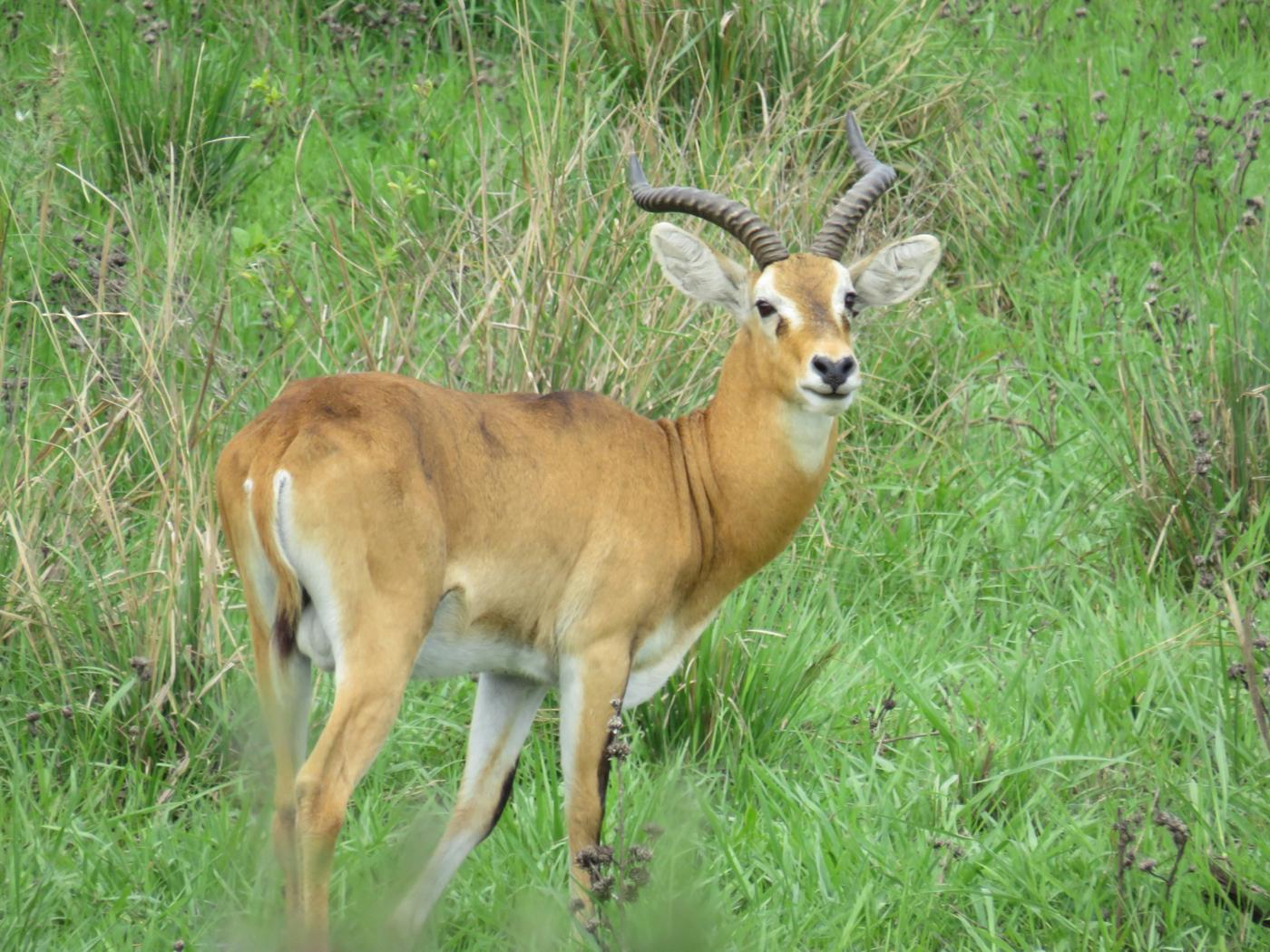
The Buhoma to Nkuringo trek is the one walk that takes you all the way across Bwindi Impenetrable National Park on foot, from the northern gate at Buhoma to the high southern ridge at Nkuringo. The Uganda Wildlife Authority lists it as the "Long Walk, Buhoma to Nkuringo", and it is also sold as the Buhoma Nkuringo hike, the Buhoma to Nkuringo trail, the River Ivi trail and the Bwindi walking safari. You leave at the park headquarters in Buhoma at about 1,500 metres, cross the Munyaga and Ivi rivers, pass through forest and then terraced farmland, and finish with a long climb to about 2,100 metres, where the Virunga volcanoes come into view. This guide covers the route, the real distance and time, how hard the last hours are, the rules, the best months, what to carry, how to fit the walk around gorilla trekking, and the mistakes that spoil the day.
Quick answer
The Buhoma to Nkuringo walk crosses Bwindi Impenetrable National Park from north to south on forest paths and village footpaths. Plan a full day: most guests leave Buhoma between 8:00 and 8:30 in the morning and reach Nkuringo between 2:00 and 3:00 in the afternoon, with stops. Published distances range from about 10 km to about 23 km because operators start, finish and detour in different places; the most commonly logged version is about 14 to 15 km. The first half is gentle. The last third climbs roughly 500 to 650 metres and is the hard part.
It is a ranger-guided walk and not a gorilla trek, so it does not use a gorilla permit and a gorilla sighting is not part of it. It suits steady walkers who are comfortable on six hours of uneven ground, and it is best in the dry months of December to February and June to August. Book it through a licensed operator so the ranger, porters, packed lunch, luggage transfer and pick-up at Nkuringo are arranged together.
The Buhoma to Nkuringo trek at a glance
| Item | What to know |
|---|---|
| Official name | Long Walk, Buhoma to Nkuringo (Uganda Wildlife Authority) |
| Also sold as | Buhoma Nkuringo hike, Buhoma to Nkuringo trail, River Ivi trail, Bwindi walking safari |
| Direction | North to south, Buhoma (Kanungu District) to Nkuringo (Kisoro District) |
| Distance | About 14 to 15 km on the most logged route; 10 to 23 km quoted by different operators |
| Walking time | 5 to 7 hours; 8 to 9 hours door to door with lunch and stops |
| Start altitude | About 1,500 m (quoted from 1,480 to 1,600 m) |
| Finish altitude | About 2,100 m |
| Net climb | Roughly 500 to 650 m, most of it in the final third |
| Difficulty | Moderate for the first half, hard for the last hours |
| Who goes with you | A ranger guide, usually a local guide and optional porters |
| Not included | A gorilla sighting; the walk does not use a gorilla permit |
| Best months | December to February and June to August |
| Park size | About 320 square kilometres; UNESCO World Heritage Site since 1994 |
Chapter 01: What is the Buhoma to Nkuringo walk?
It is a one-way crossing of the forest between two of Bwindi's four gorilla sectors. Buhoma sits at the northern edge of the park, in Kanungu District. It was the first sector opened to gorilla trekking, in 1993, and it is generally regarded as the easiest sector to reach and to trek. Nkuringo sits on a ridge on the south-western edge, in Kisoro District, looking out over the Virunga volcanoes. The two sectors are on opposite sides of the park, and the road between them goes around the outside, so the walk is not a stroll between neighbours but a real day's travel through the middle of the forest.
The walk is run by the Uganda Wildlife Authority (UWA) as a guided activity. UWA's tariff lists it by name next to other long walks in the park, which is why it appears on operators' itineraries as a standard Bwindi activity rather than an improvised hike. Many operators also call it the River Ivi trail, after the river the route crosses. Ask which start and finish your operator means when you compare quotes, because the names are used loosely.
Bwindi itself is a forest of about 320 square kilometres on the Albertine Rift, between roughly 1,190 and 2,607 metres above sea level, with more than half of it above 2,000 metres. It became a national park in 1991 and a UNESCO World Heritage Site in 1994, and about half of the world's mountain gorillas live there. The ground you cross is steep, folded and often wet, which explains both the wildlife and why the walk takes so long for its distance.
Chapter 02: How long is the trail, and how many hours does it take?
Published figures disagree, and a guest planning a day should know why. Distances in print run from about 10 km to about 23 km. Walk times run from about 3 to 4 hours at the short end to 5 to 7 hours at the long end, and a few operators suggest allowing two days.
The differences come from the route. The trail is a chain of forest paths, river valleys and village footpaths, and operators do not all start at the same gate, finish at the same trailhead or take the same side trips. A waterfall detour of about 700 metres adds distance. A route that ends at a lodge on the ridge adds more than one that ends at the Nkuringo trailhead. Water levels change which river crossings are used. The most commonly logged version puts the first trail junction at about 3 km, the River Ivi crossing at about 6.6 km, the edge of the forest at about 10.6 km and the arrival at Nkuringo at about 14.6 km. Longer figures usually include detours or a different finish.
The time is easier to plan than the distance. A typical day looks like this: leave Buhoma at about 8:00 to 8:30, take a longer stop for a packed lunch, climb through the afternoon and arrive at Nkuringo between about 2:00 and 3:00. That is five to seven hours of walking and eight to nine hours from door to door. The safe planning rule is to allow the whole day, to expect the final climb to take longer than the distance suggests, and not to book a late-afternoon activity at the finish.
Chapter 03: Why walk from Buhoma to Nkuringo and not the other way?
North to south is the usual direction, and it matters. The first half runs through the valley bottoms at the lower altitude and is the easy part. The climb to Nkuringo comes at the end, when your legs are already tired, and a guest who walks it that way meets the steepest ground in the final hours. A walker who wrote up the route found the last hour the hardest of the day and suggested that reversing it would be easier.
That is correct on the contour map. Starting at Nkuringo means starting on the ridge at about 2,100 metres and descending most of the way, which is kinder on the lungs and the legs, but it finishes in the valley at Buhoma and then needs a long vehicle journey back to wherever the next night is. Most guests choose north to south for the logistics. The choice is yours, and we plan the direction around your gorilla permit dates, the lodges you want at each end and how your legs feel. If you are unsure of your fitness for a six-hour walk with a long finishing climb, ask us to plan it from Nkuringo to Buhoma instead.
The two directions compare like this.
| Buhoma to Nkuringo | Nkuringo to Buhoma | |
|---|---|---|
| Hardest part | Final climb to about 2,100 m | Long descent on tired legs |
| Easiest part | Gentle first half in the valleys | Fast start on the ridge |
| Finish | Ridge lodge with volcano views | Valley at Buhoma |
| Best for | Fit walkers who want a dramatic finish | Walkers who doubt their legs or knees |
| Usual choice | Yes, for most guests | When fitness or logistics call for it |
Chapter 04: What is the route, hour by hour?
The walk is easiest to understand as three parts.
The first part, from Buhoma to the first trail junction at about 3 km, begins at the park headquarters at around 1,500 metres. You cross the Munyaga River early. The ground is firm, the path is wide and the forest is humid and cool, so the first hour or two feels easy. At the junction there is an optional detour of about 700 metres to a waterfall, which is worth taking in the dry season when there is water in it.
The second part, from the junction to the edge of the forest at about 10 to 11 km, is the long middle of the walk. You descend to the River Ivi, which is crossed at about 6.6 km on stepping stones. In the dry season the pools are shallow. After rain the stones are slippery and the water is higher, and your guide chooses the crossing. After the Ivi the path climbs gradually through forest and emerges onto farmland, past small plots, community tea and the houses of the people who live on the park boundary. Lunch is usually taken somewhere in this stretch, out of the forest and in the open.
The third part, from the forest edge to Nkuringo, is the climb. The last stretch gains most of the 500 to 650 metres of net height on steep tracks that can be slippery in rain. Walkers describe the last hour as much harder than the first three. At about 2,100 metres the air is thinner than at Buhoma, and some walkers notice it as breathlessness. Your ranger will stop as often as the group needs. When you reach the ridge, the Virunga volcanoes appear to the south and the forest drops away to the north.
A typical day, with approximate times, runs like this.
| Time | What happens |
|---|---|
| 6:30 to 7:30 | Early breakfast, packed lunch and water collected, luggage handed to the driver |
| 8:00 to 8:30 | Briefing with the ranger and start at the Buhoma park headquarters |
| About 9:30 | First trail junction, optional waterfall detour in the dry season |
| About 11:00 | River Ivi crossing on stepping stones |
| 12:00 to 13:00 | Lunch break near the forest edge |
| 13:00 to 14:30 | Final climb to the ridge, with rests as needed |
| 14:30 to 15:00 | Arrival at Nkuringo, hot drink, check-in |
Chapter 05: How hard is the Buhoma to Nkuringo hike?
Moderate for the first half and hard for the last. There is no technical climbing, no scrambling and no exposure, so you do not need mountain experience. What you need is the ability to walk for five to seven hours on uneven, sometimes wet ground, and to climb steadily at the end. The things that make it harder than the distance suggests are the humidity, the river crossings, the mud after rain and the length of the final ascent.
A useful test is this: if you can walk for six hours on hilly ground at home, carrying a daypack, you can do it. If a four-hour hike is your limit, choose a shorter Bwindi walk instead or ask for the reverse direction. People who are fit but unused to humidity usually find the middle of the day, not the climb, the most tiring part. Our guide to gorilla trekking fitness explains the same ground conditions from the gorilla trek's point of view, and the Nkuringo walk is longer than most gorilla treks.
Chapter 06: Is it the same as gorilla trekking, and will I see gorillas?
No. The Buhoma to Nkuringo walk is a long forest walk with a ranger, and it does not use a gorilla permit. The gorilla trek is a separate activity: the rangers locate a habituated family, up to eight visitors go in together, and you spend one hour with the gorillas. The walk is not designed to find them. Gorillas live in the same forest and the trail passes through the broader habitat, but a sighting is not part of the plan and we do not promise one. If you want gorillas, book the trek as well.
What the walk gives you instead is distance, the forest at walking pace, birds and primates by chance, river valleys, waterfalls in season, and the people who live along the edge of the park. Many guests find it a better way to understand how big the forest is than any single trek. Our guide to what happens on a gorilla trek day describes the separate gorilla experience, and the Bwindi sector guide compares the four gorilla sectors.
Chapter 07: What are the rules, the rangers and the booking process?
The walk is guided. A UWA ranger accompanies the group, as in other parts of Bwindi, and a local guide usually walks with you as well. Follow their pace and their instructions, especially at river crossings and on the climb. Do not try the route alone: the trail is not signed for independent walkers, and the ranger knows which river crossing is safe on the day.
UWA charges a separate park fee for the walk, set in its tariff, and the fee is added to your written quotation with the ranger and guide. We do not print fees in this guide because the tariff is revised from time to time, so your quotation shows the current figure. Foreign visitors book Bwindi activities through a licensed tour operator. Book early in the dry months, because lodges at both ends fill up with gorilla trekkers. Tell us your dates and how many people are in the group, and we confirm the ranger, the porters and the transfer together. Our guide to how to book gorilla permits explains the permit side if you are adding a trek.
Keep the usual forest rules: stay on the path, carry out all rubbish, do not feed or chase animals and do not leave the group. If you are unwell with a cold or stomach illness, say so before you set off, because you will be sharing narrow paths with the group for most of a day.
Chapter 08: What are Buhoma and Nkuringo like at each end?
Buhoma is the older and busier gateway. It has the widest range of lodges, a village you can walk through, a river valley at the park gate and the most established community projects. Because it was the first sector opened for gorilla trekking, in 1993, many guests start or end a Bwindi trip there, and the road in is the easiest of the four sectors.
Nkuringo is smaller, higher and wilder. It sits on a ridge, the trailhead looks south over the Virunga volcanoes and north over the forest, and the gorilla trek from the road drops steeply into the valley before climbing back out. The gorilla families habituated in this sector include the Nkuringo and Bushaho groups. Lake Mutanda lies nearby, and a dugout canoe trip there is a gentle rest-day option. Both ends have Batwa and community experiences, and both are good places to end a long day with a warm meal.
Chapter 09: When is the best time to walk from Buhoma to Nkuringo?
The dry months, December to February and June to August, are the best. The ground is firmer, the river crossings are easier, the waterfall detour is more rewarding and the final climb is less slippery. The wetter months, March to May and September to November, are possible, but you should expect mud, higher rivers, slower progress and the possibility that your guide changes the crossing or shortens the day.
Bwindi is a rainforest, so no month is guaranteed dry, and the rain can arrive in the afternoon when you are on the climb. In the rainy months, plan more time, carry a proper rain jacket and put everything in a dry bag. Our best time to visit Uganda guide has the month-by-month picture, and the East Africa safari weather guide explains how the rains work.
Chapter 10: What should I wear and carry?
Wear lightweight, quick-drying long trousers and a long-sleeved shirt, because the path runs through nettles, thorny vines and ants. Tuck the trousers into your socks. Wear waterproof or well-gripping hiking boots that are already broken in, since new boots cause blisters over a day like this. Avoid black and very bright colours.
Carry a small daypack with a rain jacket, a warm layer for the early morning and for the ridge, a hat, sun cream, insect repellent, a spare pair of socks and thin gardening gloves for steadying yourself on branches. Take at least two litres of water, plus snacks, and ask your lodge to prepare a packed lunch. A walking stick helps on the descents and the climb. Bring binoculars and a camera in a waterproof bag. Pack the rest of your luggage in a soft bag, because porters or your driver carry it separately. Our East Africa safari packing list covers the full kit.
Chapter 11: Should I hire a porter?
Yes, for the walk and also for the sake of the people who live around the park. A porter carries your daypack or main bag, steadies you at river crossings and gives you a hand on the climb. Porters come from the surrounding villages, and the work is a direct source of income for local households. The guide's support at the hardest moments is a real advantage on a day this long.
We arrange porters when you book. Ask for one porter per walker if you are carrying camera gear or are not used to long walks. The same courtesy applies to tipping: our safari tipping guide explains what is normal for rangers, guides and porters.
Chapter 12: Who lives along the trail?
The trail is a walk through the edge of a populated landscape. Villages, small farms and community tea plantations line the park boundary on the way, and the path uses the footpaths that local people use. Greet people, ask before you take photographs and avoid handing out sweets or money to children, which encourages begging.
Bwindi is also the ancestral forest of the Batwa, who lived in and from it for generations before it became a national park in 1991. Many Batwa now live in communities around the park, and several lodges and community groups around both Buhoma and Nkuringo offer Batwa-led walks and cultural visits. If you want to meet the Batwa, ask us to add a community visit before or after the long walk, and choose one that is run by the community itself. Our guide to responsible and sustainable safari travel explains how to choose experiences that benefit local people.
Chapter 13: What will I see on the way?
Mostly forest, and it is dense, dripping and green. Bwindi has about 120 mammal species, including ten primates, and more than 350 bird species, 23 of them Albertine Rift endemics. On a day walk you will hear far more than you see, and the best results come from walking quietly and stopping when the guide stops. Monkeys, forest birds, butterflies, bright fungi, tree ferns and big buttress-rooted trees are the usual sights. Gorillas, chimpanzees and elephants live in the forest but are not on the plan.
Birders should tell us in advance, because the Buhoma to Nkuringo crossing passes through a wide range of altitudes and habitats, and a guide who knows the calls will find far more. Our birding safari guide explains how to build a birding route. In the open sections and on the ridge, look for the farmland, the terraces and, if the day is clear, the Virunga volcanoes.
Chapter 14: How do I get to Buhoma, and how do I leave Nkuringo?
Buhoma is a long day by road from Kampala, usually eight to ten hours, or a short flight from Entebbe or Kajjansi to the Kihihi airstrip followed by a drive. Many guests fly because it saves a day, which our guide to fly-in versus road safaris compares in detail. Nkuringo's nearest town is Kisoro, and the Kisoro airstrip and the road through Kabale are the usual routes.
Your driver-guide cannot meet you at the end of the walk by driving across the forest, because the road goes around the outside of the park and takes several hours. We position the vehicle and your luggage at the Nkuringo end by prior arrangement. When you reach the ridge, your lodge is there and the vehicle is waiting. If you plan to continue to Kisoro, Lake Mutanda, Mgahinga or the Rwanda border, tell us, and we plan the next leg from Nkuringo. Our Mgahinga Gorilla National Park guide and the guide to Uganda and Rwanda gorilla trekking combined cover the usual next steps.
Chapter 15: Where do I sleep at each end?
At Buhoma you have a choice that runs from community rest camps and small guesthouses to mid-range and luxury forest lodges, many within walking distance of the park headquarters. At Nkuringo the choice is smaller, and the lodges sit on the ridge with views over the volcanoes and the forest. Because the walk ends on the ridge, the lodge at the finish matters. A warm shower, a hot meal and a view at the end of a six-hour walk make a real difference.
We choose lodges to match your style, your budget and the direction of the walk, and we confirm them on the quotation. See our lodges page for the properties we use, and our Uganda safari packages guide for how lodge choice changes a trip.
Chapter 16: How do I fit the walk around gorilla trekking?
A simple four-night plan works well. Arrive at Buhoma on day one and rest. Do the Buhoma gorilla trek on day two, since Buhoma is generally regarded as the more accessible sector. Walk to Nkuringo on day three and sleep on the ridge. On day four rest, visit a community or Lake Mutanda, or take the Nkuringo gorilla trek if your legs are fresh, and move on the next morning. We do not recommend the walk and a gorilla trek on the same day.
If you want only one gorilla trek, choose the sector that suits you. Nkuringo's trek starts at the road and drops steeply into a valley, and it ends with a climb back out, so it is a hard trek. After a long walk across the forest, a day of rest between the two is wise. A five-night plan with the walk on day three, a rest day and the Nkuringo trek on day five is more comfortable for most guests. We build the exact order around your permit dates, because the gorilla permit date is the one thing you cannot move.
Our classic gorilla trekking safari and Uganda primates safari show how a trek fits into a full trip, and our gorilla trekking in Uganda page explains the sectors and permit rules.
Chapter 17: What other long walks are there in Bwindi?
UWA lists several. The guided Long Walk from Rushaga to Nyabaremura crosses the southern forest, the Rushura Hill walk, also called the Muzabajiro Loop, climbs to a viewpoint, and the bamboo walk at Ruhija climbs to the high bamboo zone. Shorter nature walks, bird walks and community walks are available at each sector.
None of these crosses the whole park the way the Buhoma to Nkuringo walk does. If you have less time or less stamina, the Rushura Hill loop and the Ruhija bamboo walk are shorter ways to feel the forest, and a Buhoma village walk or a Batwa visit takes a half day. Our Bwindi sector guide explains what each sector offers.
Chapter 18: How should I train?
Start four to six weeks before travel. Walk on hills for one to two hours three times a week in the boots you will wear, and make one walk a weekend of four to six hours, with a loaded daypack. Add stair climbing or step-ups for the legs, because the final ascent is long and sustained. If you live somewhere flat, use stairs, a treadmill with an incline or a stair machine.
Wear the boots and trousers on your training walks so that you know they work. Practise walking on wet or loose ground if you can. Bring the habit of drinking regularly and eating small snacks, since people tire in the humid middle of the day if they do not. Our gorilla trekking fitness guide has more detail on preparation.
Chapter 19: What about health, safety and insurance?
Bwindi is in a malaria region, and your doctor or travel clinic should advise on prophylaxis before you travel. Our malaria and vaccination guide explains what to ask. Take insect repellent and wear long sleeves. Bring a basic first-aid kit with blister plasters, antiseptic, rehydration salts and any personal medication, and tell your guide about any medical condition before you set off.
Once you are in the forest section, the only way out is on foot, so good insurance with emergency evacuation cover matters. Read the travel insurance and evacuation guide before you buy. Drink plenty of water and use sun protection on the open farmland. Follow the ranger's instructions without exception, especially around rivers and steep ground.
Chapter 20: What mistakes should I avoid?
Starting too late is the common one. A walk that begins at 10:00 and ends in the dark is far harder than one that starts at 8:00. Wearing new boots, carrying too little water, skipping the packed lunch and booking a gorilla trek for the morning after a hard walk without a rest day are the others. Treating the walk as a gorilla trek, expecting to see gorillas, is a mistake that disappoints guests, so we explain it before you go.
Underestimating the last climb is the most important. The first three hours are easy and misleading. Pace yourself, drink and eat early, and let the group's slowest walker set the speed. Do not attempt it in flip-flops or sandals, or in cotton clothes that do not dry. Finally, do not trust any single published distance or time. Plan for a full day and accept the ranger's decisions.
Chapter 21: Is the Buhoma to Nkuringo walk worth it?
Yes, for the right guest. It is the best way to feel the scale of Bwindi, and it ends on one of the most dramatic ridges in Uganda. It suits active travellers, repeat visitors to Uganda, couples and small groups who want more than one trek, and anyone who wants to see the forest and its communities at walking pace. It does not suit guests with limited mobility, anyone uneasy about a long day on steep ground or anyone who wants a short, easy outing.
If you are comparing it with a second gorilla trek, think of the walk as a different kind of day: no permit hour with the gorillas, but a full day in the forest and a finish that most guests remember. Tell us your dates, your group and your fitness, and we reply within 24 hours with a route, the direction of the walk and a written quotation. For the wider picture, start with the Uganda national parks guide and the Uganda complete local guide.
Plan the walk with us
The walk fits well into our 10 day Uganda safari, our Uganda complete safari through Bwindi, Queen Elizabeth and Murchison and our Uganda family primate safari for older teenagers who walk regularly. We can also add it to a Uganda and Rwanda double gorilla safari or to a custom trip. See all our safaris, read the gorilla permits page, or open the Uganda destination page for the parks we plan.
Plan the walk with us. Tell us your dates, how many are walking and how fit you feel, and we will reply within 24 hours with the direction, the ranger, porters, lodges and a written quotation.
Request a free quotationBring binoculars: our birding in Bwindi guide explains what to look for on forest walks.
Looking for where to stay at either end? See our best lodges in Bwindi.